A glimpse of the future: Mount Pleasant’s preferred plans presented at final event
Plans include multiple roundabouts on N. Mission Street

City staff and residents discuss proposed plans at a final charrette event April 11 at City Hall.
As of Thursday night, the once orderly commission chamber at City Hall had been transformed into an untidy studio space for McKenna Associates’ team of designers, consultants and analysts.
McKenna Associates (MA) provides development, planning and building services to cities while engaging with the community. It is the business working to complete "Mount Pleasant 2050," which will chart the city’s development for the next 30 years. President John Jackson said, under state law, Mount Pleasant is obligated to create a master plan and is using the opportunity to line up its future goals with more immediate changes and ordinances.
After four days of gathering input from city staff and Mount Pleasant residents, MA presented its findings at a final charrette event April 11 at City Hall. Jackson said the team will continue refining proposed plans into winter 2019 and hopes the city will be able to adopt plans in spring 2020.


In addition to planning events, Mount Pleasant used online surveys to gather responses from residents. The team received 89 responses from four surveys, which will remain open until April 21.
Director of Urban Design and Mobility Paul Lippens, who played a leadership role in the project, said some of the more overwhelming responses received from residents and staff was the need for mobility and sustainable land use. The team divided improvement plans into two categories — transportation and land use. Potential improvements to downtown were also looked at.
The maps below show the proposed changes to improve each.
Improvement of Transportation
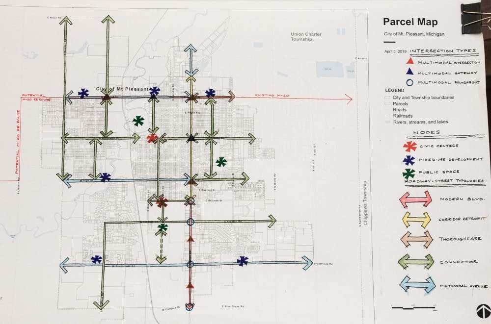
Improving transportation would include the implementation of four roundabouts on N. Mission Street at Bellows Street, E. Preston Road, W. Broomfield Road and E. Bluegrass Road. The purpose of the roundabouts is to decrease traffic on one of Mount Pleasant's more active roads, Lippens said.
Changes to road systems and intersections will increase safety and aesthetics, and gateway features will be made more effective and visually appealing, Lippens said.
The city is also looking into re-routing M-20, diverting traffic around downtown. Jackson said the change is supported by Mount Pleasant business owners and will require participation and partnerships from multiple districts and agencies to complete.
Improvement of Land Use
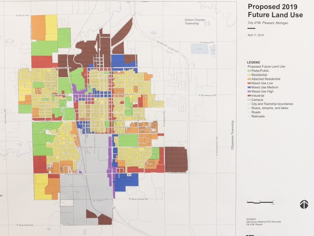
The above map shows the consensus between two different maps developed by city staff and planners throughout the week. CMU's campus and industrial zones remain similar in the proposed future land use map.
Jackson said he found Mount Pleasant to have a good block system and would like to see it improved upon. A more prominent improvement of land use would be adding five-story, high-density mixed-use buildings to the downtown area (areas purple on map).
At the event, Lippens reiterated from Monday’s event the high regard residents have for Mount Pleasant’s park system, calling it the city’s “backbone.”
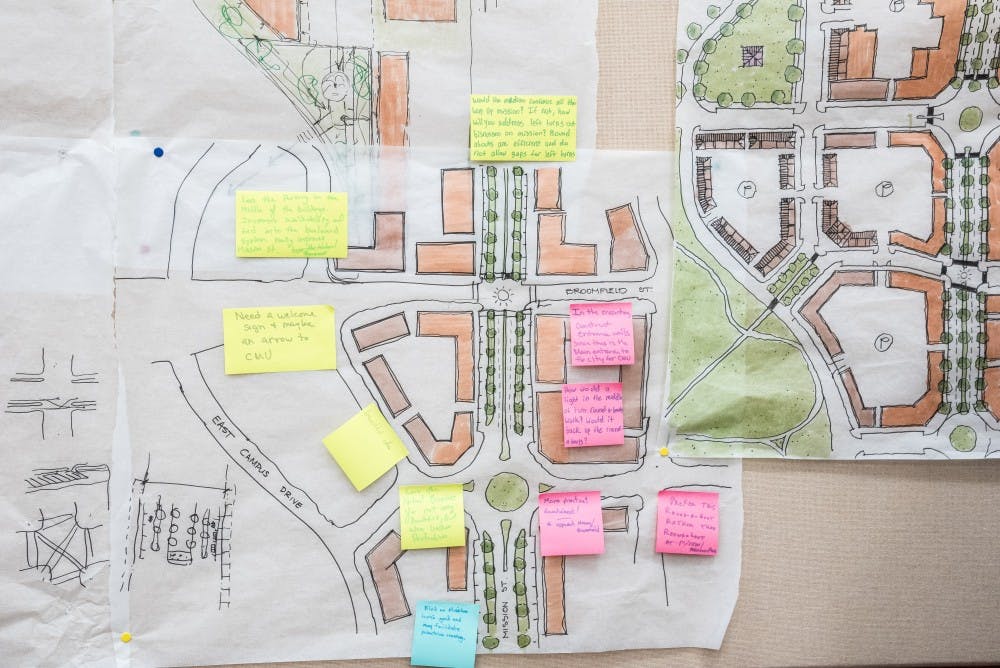
Improvements to downtown area
The team's attention was also on downtown to promote it as the "vital center of the city," Lippens said. The team focused on three areas — Mission Street, Town Center and Pickard Road.
Mission Street
Improvements to Mission Street would include:
- Roundabouts utilized for traffic management
- Landscape medians for visual enhancement and traffic control
- Retrofitted street grids
- Re-use of underutilized parking lots for infill development
- New parking located behind buildings
- Making Mission Street the residential “front door” to Central Michigan University
Town Center

Improvements to the Town Center would include:
- Expanded public gathering space at Main Street and Broadway Street
- Flexible event programming availability
- New on-street parking
- New direct connections to Island Park via trails and pedestrian bridge
- Integrated river view apartments
Pickard Road
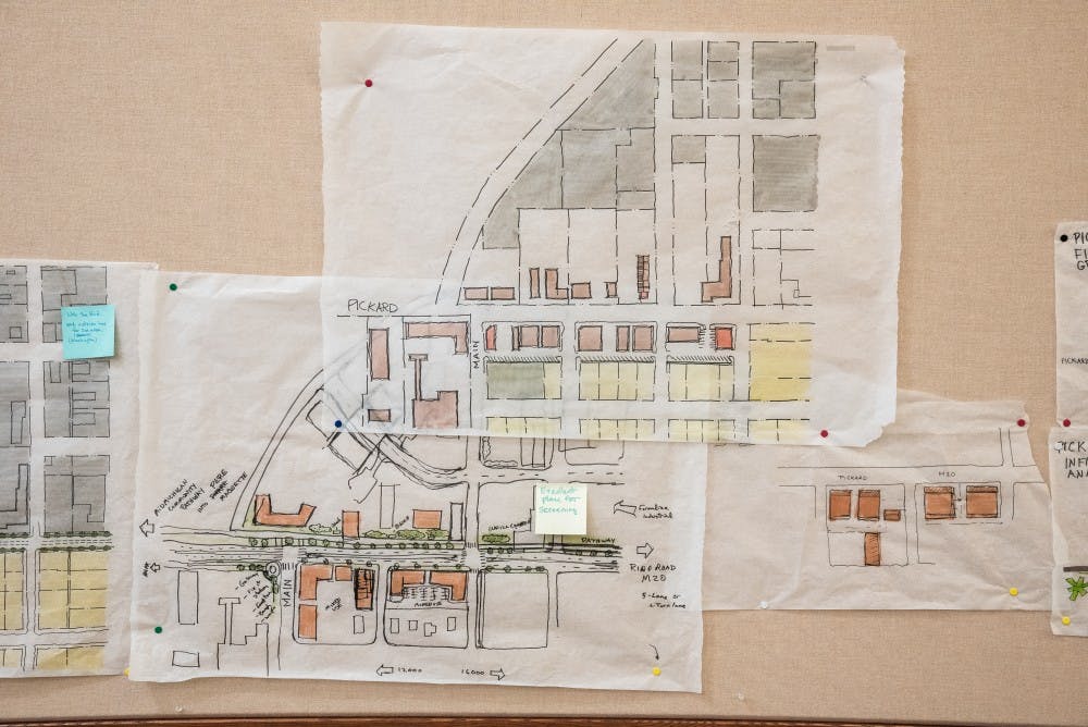
Improvements to Pickard would include:
- Aesthetics and safety with landscaping and reconfigured 3-lane cross-section
- Gateway feature to downtown at Main Street
- The ability to recognize the effectiveness of existing industrial district
- Support of entrepreneurship and creation of job opportunities
CMU Involvement
Not only residents and city staff gave their input and feedback to the team. Lippens said the strong presence of CMU students and staff were “vital” to the process of mapping Mount Pleasant's future. The team tried to treat the edges of campus in a complimentary way going off their feedback, he said.
For students who plan to graduate and leave Mount Pleasant, Lippens said they can still invest in the relation and identity shared between CMU and the city for future students.
“It's part of becoming a civic engagement-oriented person, and it’s something students must achieve while at a university,” he said.


